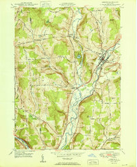
1950 Map of Greene
USGS Topo · Published 1950About this map
The Chenango River valley serves as the central artery for this mid-century Chenango County landscape, anchored by the village of Greene. Following the river's path is the D L & W RR, which shaped the local economy alongside historic overland routes like the Catskill Turnpike. The map reveals a high concentration of small rural burial grounds, including Horton Cem, Morse Cem, and Sylvan Lawn Cem, offering significant value for genealogists tracing family footprints in the area.
Find a feature on this map
33 named features on this map. Tap any name to fly to it.
Don’t see what you’re looking for? This feature index may not catch every label — zoom into the map to look around manually.
Map Details
Editions of this 1950 Greene Map
This is the sole edition of this map. No revisions or reprints were ever made.
Other maps of this area

1902 · Coventry
USGS Topo · 1:62,500

1904 · Binghamton
USGS Topo · 1:62,500

1904 · Greene
USGS Topo · 1:62,500

1904 · Oxford
USGS Topo · 1:62,500

1905 · Nineveh
USGS Topo · 1:62,500

1934 · Castle Creek
USGS Topo · 1:24,000

1935 · Chenango Forks
USGS Topo · 1:24,000

1942 · Castle Creek
USGS Topo · 1:31,680

1942 · Chenango Forks
USGS Topo · 1:31,680
1948 · Greene
USGS Topo · 1:24,000