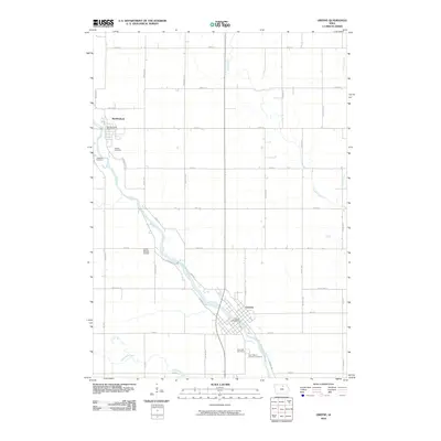
2010 Map of Greene
USGS Topo · Published 2010About this map
The Shell Rock River defines the corridor of settlement in this northern Iowa landscape, connecting the communities of Greene and Marble Rock. This 2010 survey illustrates a region where rural infrastructure and agriculture converge, with the river providing a natural focal point for local navigation and access at points like the Gates Bridge Access. The town of Greene serves as a hub, anchored by its Greene Post Office and surrounded by established landmarks such as Rose Hill Cemetery and Saint Marys Catholic Cemetery.
Find a feature on this map
46 named features on this map. Tap any name to fly to it.
Don’t see what you’re looking for? This feature index may not catch every label — zoom into the map to look around manually.
Map Details
Editions of this 2010 Greene Map
This is the sole edition of this map. No revisions or reprints were ever made.
Other maps of this area

1954 · Mason City
USGS Topo · 1:250,000

1954 · Waterloo
USGS Topo · 1:250,000

1955 · Waterloo
USGS Topo · 1:250,000

1957 · Mason City
USGS Topo · 1:250,000

1958 · Mason City
USGS Topo · 1:250,000

1971 · Rockford
USGS Topo · 1:24,000

1971 · Charles City
USGS Topo · 1:24,000

1971 · Nashua NW
USGS Topo · 1:24,000

1971 · Clarksville
USGS Topo · 1:24,000
1971 · Roseville
USGS Topo · 1:24,000