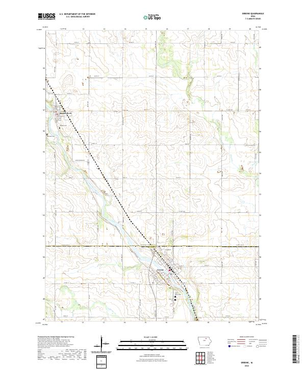
2022 Map of Greene
USGS Topo · Published 2022About this map
The Shell Rock River defines the landscape of this northern Iowa region, winding southeastward through the primary settlements of Marble Rock and Greene. This 2022 survey captures the distinct grid of rural section lines and county roads, such as Co Hwy B60 and Floyd Line St, that separate the rolling agricultural fields from the river valley. The map is particularly useful for genealogists, as it meticulously identifies local burial grounds including Rose Hill Cem and Saint Marys Cem near the southern town limits, as well as Hillside Cem and Westside Cem further upstream.
Find a feature on this map
40 named features on this map. Tap any name to fly to it.
Don’t see what you’re looking for? This feature index may not catch every label — zoom into the map to look around manually.
Map Details
Editions of this 2022 Greene Map
This is the sole edition of this map. No revisions or reprints were ever made.
Other maps of this area

1954 · Mason City
USGS Topo · 1:250,000

1954 · Waterloo
USGS Topo · 1:250,000

1955 · Waterloo
USGS Topo · 1:250,000

1957 · Mason City
USGS Topo · 1:250,000

1958 · Mason City
USGS Topo · 1:250,000

1971 · Rockford
USGS Topo · 1:24,000

1971 · Charles City
USGS Topo · 1:24,000

1971 · Nashua NW
USGS Topo · 1:24,000

1971 · Clarksville
USGS Topo · 1:24,000
1971 · Roseville
USGS Topo · 1:24,000