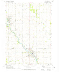
1972 Map of Greene
USGS Topo · Published 1975About this map
Marble Rock and the surrounding Butler County landscape are defined by the winding course of the Shell Rock River, which serves as the primary geographic corridor through this section of northern Iowa. In the early 1970s, the Chicago Rock Island and Pacific railroad remained a critical artery for the region, cutting diagonally across the terrain to connect small riverside communities. The map highlights the localized nature of early 1970s land use, from the Picnic Area and Golf Course near the river to the scattered Quarry and Gravel Pits that supported local industry.
Find a feature on this map
22 named features on this map. Tap any name to fly to it.
Don’t see what you’re looking for? This feature index may not catch every label — zoom into the map to look around manually.
Map Details
Editions of this 1972 Greene Map
This is the sole edition of this map. No revisions or reprints were ever made.
Other maps of this area

1954 · Mason City
USGS Topo · 1:250,000

1954 · Waterloo
USGS Topo · 1:250,000

1955 · Waterloo
USGS Topo · 1:250,000

1957 · Mason City
USGS Topo · 1:250,000

1958 · Mason City
USGS Topo · 1:250,000

1971 · Rockford
USGS Topo · 1:24,000

1971 · Charles City
USGS Topo · 1:24,000

1971 · Nashua NW
USGS Topo · 1:24,000

1971 · Clarksville
USGS Topo · 1:24,000
1971 · Roseville
USGS Topo · 1:24,000