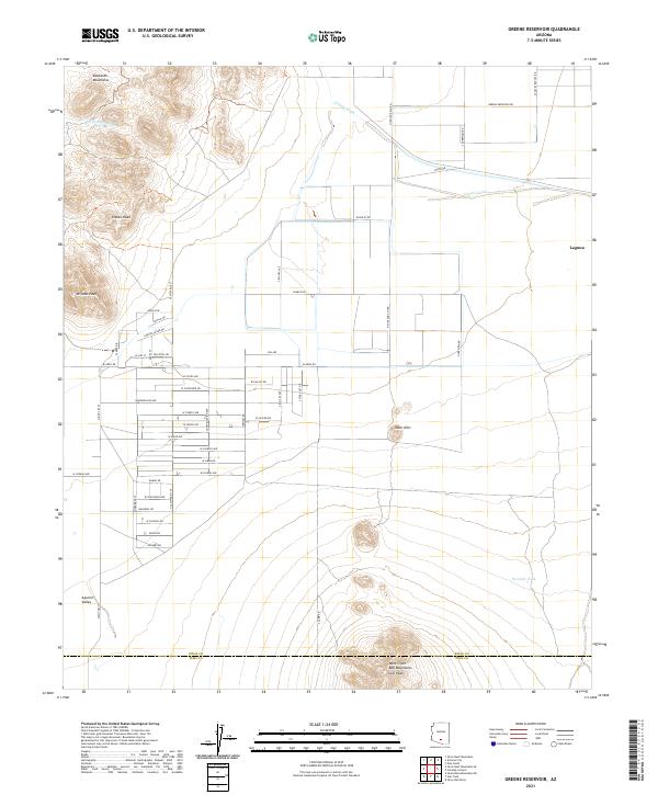
2021 Map of Greene Reservoir
USGS Topo · Published 2021About this map
Aguirre Valley forms the basin for this Pinal County landscape, where the southern reaches of the Sawtooth Mountains and northern slopes of the West Silver Bell Mountains converge. The topography is defined by ephemeral drainages and water management, notably Silver Reef Wash and the Greene Canal, which reflect the region's historical reliance on irrigation and seasonal runoff. Distinctive landmarks like Indian Head and Wildcat Peak rise above the basin, serving as natural orientation points in an area largely characterized by a grid-like network of named rural roads.
Find a feature on this map
60 named features on this map. Tap any name to fly to it.
Don’t see what you’re looking for? This feature index may not catch every label — zoom into the map to look around manually.
Map Details
Editions of this 2021 Greene Reservoir Map
This is the sole edition of this map. No revisions or reprints were ever made.
Other maps of this area

1934 · Silver Bell
USGS Topo · 1:125,000

1942 · Silver Reef Mountains
USGS Topo · 1:62,500

1947 · Eloy
USGS Topo · 1:62,500

1948 · Eloy
USGS Topo · 1:62,500

1956 · Tucson
USGS Topo · 1:250,000

1958 · Tucson
USGS Topo · 1:250,000

1959 · Tucson
USGS Topo · 1:250,000

1959 · Vaca Hills
USGS Topo · 1:62,500

1962 · Tucson
USGS Topo · 1:250,000
1963 · Santa Rosa Mountains
USGS Topo · 1:62,500