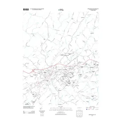
2013 Map of Greeneville
USGS Topo · Published 2013About this map
Richland Creek and its many tributaries, including Tipton Creek and Simpson Creek, carve through this section of Greene County as they flow toward the Nolichucky River. The landscape is a dense network of suburban expansion and historical industry, anchored by the Norfolk Southern rail line. To the east, the community of Tusculum and its various residential developments like College View and Tusculum Heights sit near College Creek.
Find a feature on this map
337 named features on this map. Tap any name to fly to it.
Don’t see what you’re looking for? This feature index may not catch every label — zoom into the map to look around manually.
Map Details
Editions of this 2013 Greeneville Map
This is the sole edition of this map. No revisions or reprints were ever made.
Other maps of this area

1892 · Greeneville
USGS Topo · 1:125,000

1896 · Greeneville
USGS Topo · 1:125,000

1904 · Greeneville
USGS Topo · 1:125,000

1935 · Surgoinsville
USGS Topo · 1:48,000

1935 · Baileyton
USGS Topo · 1:24,000

1935 · McCloud
USGS Topo · 1:24,000

1935 · Mosheim
USGS Topo · 1:24,000

1935 · Cedar Creek
USGS Topo · 1:24,000

1935 · Fall Branch
USGS Topo · 1:48,000
1935 · Jearoldstown
USGS Topo · 1:24,000