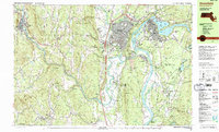
1990 Map of Greenfield
USGS Topo · Published 1990About this map
The confluence of the Connecticut River and the Deerfield River anchor this 1990 survey of Franklin County, showing a landscape defined by industrial heritage and education. The town of Greenfield and the neighboring village of Turners Falls appear as established hubs, connected by the Boston and Maine Railroad and the historic Mohawk Trail. Local history is preserved in numerous burial grounds like Old Albany Cem and the Our Lady of Czestochowa Cem.
Find a feature on this map
127 named features on this map. Tap any name to fly to it.
Don’t see what you’re looking for? This feature index may not catch every label — zoom into the map to look around manually.
Map Details
Editions of this 1990 Greenfield Map
3 editions found
Other maps of this area

1885 · Northampton
USGS Topo · 1:62,500

1886 · Hawley
USGS Topo · 1:62,500

1886 · Chesterfield
USGS Topo · 1:62,500

1886 · Northampton
USGS Topo · 1:62,500

1887 · Warwick
USGS Topo · 1:62,500

1887 · Belchertown
USGS Topo · 1:62,500

1888 · Chesterfield
USGS Topo · 1:62,500

1889 · Warwick
USGS Topo · 1:62,500

1890 · Hawley
USGS Topo · 1:62,500

1890 · Belchertown
USGS Topo · 1:62,500