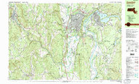
1990 Map of Greenfield
USGS Topo · Published 1990About this map
The Connecticut River and Deerfield River define the industrial and agricultural landscape of Franklin County in this 1990 survey. The regional hub of Greenfield is shown in detail, where the historic Mohawk Trail meets the Boston and Maine RR network. These transportation corridors supported the development of satellite settlements like Turners Falls, Shelburne Falls, and Deerfield. The map captures a high density of educational institutions, from the Greenfield Community College campus to private schools like the Eaglebrook Sch and Bement Sch.
Find a feature on this map
119 named features on this map. Tap any name to fly to it.
Don’t see what you’re looking for? This feature index may not catch every label — zoom into the map to look around manually.
Map Details
Editions of this 1990 Greenfield Map
3 editions found
Other maps of this area

1885 · Northampton
USGS Topo · 1:62,500

1886 · Hawley
USGS Topo · 1:62,500

1886 · Chesterfield
USGS Topo · 1:62,500

1886 · Northampton
USGS Topo · 1:62,500

1887 · Warwick
USGS Topo · 1:62,500

1887 · Belchertown
USGS Topo · 1:62,500

1888 · Chesterfield
USGS Topo · 1:62,500

1889 · Warwick
USGS Topo · 1:62,500

1890 · Hawley
USGS Topo · 1:62,500

1890 · Belchertown
USGS Topo · 1:62,500