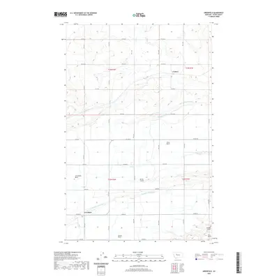
2020 Map of Greenfield
USGS Topo · Published 2020About this map
The agricultural landscape of Teton County is defined by a series of geographic terraces known as First Bench, Second Bench, and Third Bench, which step down across this portion of central Montana. The settlement of Greenfield sits at the base of the Greenfields Bench, where the engineering of the Greenfields Main Canal provides the essential water for this high-plains environment. This network of irrigation is further supported by the Plummer Lateral and drainage systems like Thompson Drain, illustrating the coordinated water management required for farming in the region. To the north, the small community of Cordova is situated amidst a grid of rural roads, including 8th Rd NE and 9th Ln NE. The terrain is cut by natural features such as Spring Coulee and Cascade Coulee, which disrupt the otherwise orderly rectangular survey of the township and range lines.
Find a feature on this map
31 named features on this map. Tap any name to fly to it.
Don’t see what you’re looking for? This feature index may not catch every label — zoom into the map to look around manually.
Map Details
Editions of this 2020 Greenfield Map
This is the sole edition of this map. No revisions or reprints were ever made.
Other maps of this area

1886 · Great Falls
USGS Topo · 1:250,000

1949 · Vaughn
USGS Topo · 1:62,500

1950 · Fairfield
USGS Topo · 1:62,500

1950 · Dutton
USGS Topo · 1:62,500

1950 · Collins
USGS Topo · 1:62,500

1952 · Vaughn
USGS Topo · 1:62,500

1954 · Great Falls
USGS Topo · 1:250,000

1957 · Great Falls
USGS Topo · 1:250,000

1976 · Great Falls North
USGS Topo · 1:100,000
1983 · Fort Shaw
USGS Topo · 1:24,000