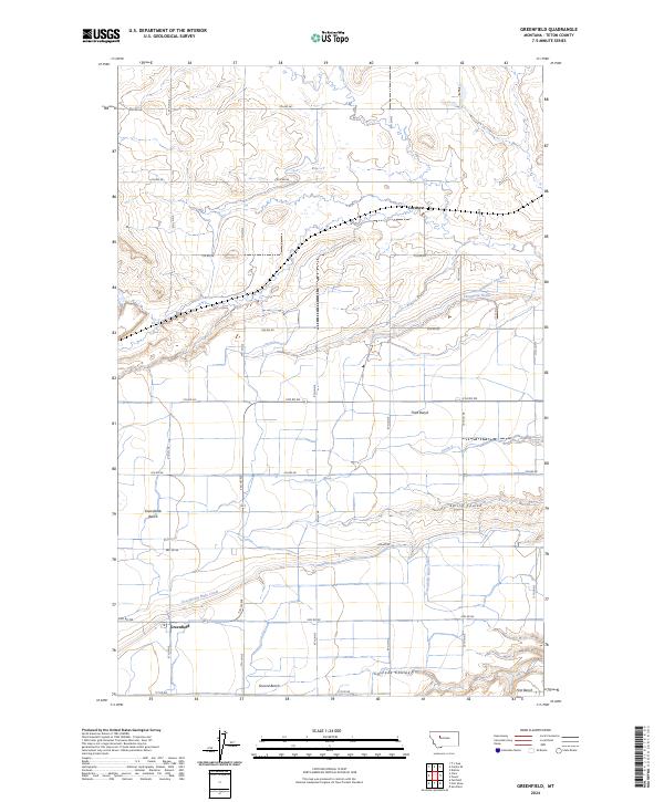
2024 Map of Greenfield
USGS Topo · Published 2024About this map
Greenfield sits at the heart of an engineered agricultural landscape in Teton County, where a complex network of irrigation infrastructure transforms the Montana plains. The topography is defined by a series of geographic steps including the Third Bench, Second Bench, and First Bench, alongside the expansive Greenfields Bench. Water management is the primary driver of settlement here, evidenced by the extensive Greenfields Main Canal and the Plummer Lateral, which feed into numerous drainage systems like Thompson Drain and Drain E. The small settlement of Cordova appears in the northern portion of the map, situated amidst a grid of rural roads. The landscape transition between the flat benches and the natural carving of Spring Coulee and Cascade Coulee reveals the intersection of natural hydrology and human-made water diversion essential for high-plains farming.
Find a feature on this map
67 named features on this map. Tap any name to fly to it.
Don’t see what you’re looking for? This feature index may not catch every label — zoom into the map to look around manually.
Map Details
Editions of this 2024 Greenfield Map
This is the sole edition of this map. No revisions or reprints were ever made.
Other maps of this area

1886 · Great Falls
USGS Topo · 1:250,000

1949 · Vaughn
USGS Topo · 1:62,500

1950 · Fairfield
USGS Topo · 1:62,500

1950 · Dutton
USGS Topo · 1:62,500

1950 · Collins
USGS Topo · 1:62,500

1952 · Vaughn
USGS Topo · 1:62,500

1954 · Great Falls
USGS Topo · 1:250,000

1957 · Great Falls
USGS Topo · 1:250,000

1976 · Great Falls North
USGS Topo · 1:100,000
1983 · Fort Shaw
USGS Topo · 1:24,000