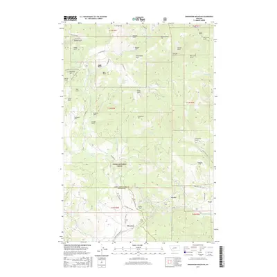
2017 Map of Greenhorn Mountain
USGS Topo · Published 2017About this map
Blossburg sits near the southern boundary of this map, marking a critical point where the railroad passage meets the landscape of the Helena National Forest. The geography is defined by the Continental Divide, represented here by Mullan Pass and the engineering feat of the Mullan Tunnel. This area in Lewis and Clark County and Powell County is characterized by a dense network of gulches and ridges, reflecting a legacy of resource extraction and mountain transit. Notable peaks such as Bald Butte, Mt Belmont, and Greenhorn Mtn overlook a series of drainages including Silver Cr, Empire Cr, and Greenhorn Cr. The map reveals the intricate placement of smaller settlements like Skyline and Weed along the winding mountain roads. Water sources such as Sawmill Spring and the Beaver Ponds are tucked into the drainages of American Gulch and Thompson Flats, providing vital points of interest for those studying the high-altitude topography and early settlement patterns of the region.
Find a feature on this map
61 named features on this map. Tap any name to fly to it.
Don’t see what you’re looking for? This feature index may not catch every label — zoom into the map to look around manually.
Map Details
Editions of this 2017 Greenhorn Mountain Map
This is the sole edition of this map. No revisions or reprints were ever made.
Other maps of this area

1889 · Helena
USGS Topo · 1:250,000

1893 · Helena
USGS Topo · 1:250,000

1899 · Helena
USGS Topo · 1:250,000

1903 · Helena
USGS Topo · 1:250,000

1947 · Butte
USGS Topo · 1:250,000

1950 · Helena
USGS Topo · 1:62,500

1958 · Butte
USGS Topo · 1:250,000

1959 · Elliston
USGS Topo · 1:62,500

1960 · Butte
USGS Topo · 1:250,000

1962 · Butte
USGS Topo · 1:250,000