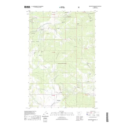
2020 Map of Greenhorn Mountain
USGS Topo · Published 2020About this map
Marysville sits at the northern edge of this high-country landscape, where the legacy of mining and mountain transit is etched into the terrain of Helena National Forest. The geography is defined by the Continental Divide, which is traversed by the Continental Divide National Scenic Trail. Near the center of the map, Bald Butte and Drumlummon Hill overlook a network of gulches—including American Gulch and Ottawa Gulch—that hint at the area's gold-seeking history. To the south, the infrastructure of the Continental Divide crossing becomes more pronounced. Mullan Pass and the nearby Mullan Tunnel serve as critical transit points through the mountains, connecting the drainage of Austin Creek with the southern settlement of Blossburg. This area illustrates the late-twentieth and early-twenty-first-century management of public lands, balancing historic trail access with forestry roads like National Forest Development Road 4105.
Find a feature on this map
74 named features on this map. Tap any name to fly to it.
Don’t see what you’re looking for? This feature index may not catch every label — zoom into the map to look around manually.
Map Details
Editions of this 2020 Greenhorn Mountain Map
This is the sole edition of this map. No revisions or reprints were ever made.
Other maps of this area

1889 · Helena
USGS Topo · 1:250,000

1893 · Helena
USGS Topo · 1:250,000

1899 · Helena
USGS Topo · 1:250,000

1903 · Helena
USGS Topo · 1:250,000

1947 · Butte
USGS Topo · 1:250,000

1950 · Helena
USGS Topo · 1:62,500

1958 · Butte
USGS Topo · 1:250,000

1959 · Elliston
USGS Topo · 1:62,500

1960 · Butte
USGS Topo · 1:250,000

1962 · Butte
USGS Topo · 1:250,000