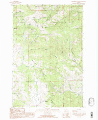
1989 Map of Greenhorn Mountain
USGS Topo · Published 1989About this map
Marysville sits nestled among the high peaks of the Continental Divide, serving as a focal point for a landscape defined by 19th-century mining legacy. This 1989 provisional study of the Helena National Forest reveals the dense concentration of lode operations that once drove the local economy, including the Empire Mine, Shannon Mine, and Belmont Mine near Mount Belmont. The rugged terrain is etched with the history of extraction, from the Ottawa Mine in Drumlummon Gulch to the Strawberry Mine (Prospect) further east.
Find a feature on this map
54 named features on this map. Tap any name to fly to it.
Don’t see what you’re looking for? This feature index may not catch every label — zoom into the map to look around manually.
Map Details
Editions of this 1989 Greenhorn Mountain Map
This is the sole edition of this map. No revisions or reprints were ever made.
Other maps of this area

1889 · Helena
USGS Topo · 1:250,000

1893 · Helena
USGS Topo · 1:250,000

1899 · Helena
USGS Topo · 1:250,000

1903 · Helena
USGS Topo · 1:250,000

1947 · Butte
USGS Topo · 1:250,000

1950 · Helena
USGS Topo · 1:62,500

1958 · Butte
USGS Topo · 1:250,000

1959 · Elliston
USGS Topo · 1:62,500

1960 · Butte
USGS Topo · 1:250,000

1962 · Butte
USGS Topo · 1:250,000