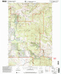
2001 Map of Greenhorn Mountain
USGS Topo · Published 2004About this map
Marysville sits at the northern edge of this high-elevation terrain, marking a landscape defined by significant mining history and mountain passage. The area is a complex of summits including Mount Belmont and Bald Butte, crisscrossed by the Continental Divide Scenic Trail as it winds along the border of Lewis and Clark and Powell counties. Industrial history is evident in the numerous prospects and mine shafts scattered throughout the gulches, including the Drumlummon works and the Strawberry Mine.
Find a feature on this map
57 named features on this map. Tap any name to fly to it.
Don’t see what you’re looking for? This feature index may not catch every label — zoom into the map to look around manually.
Map Details
Editions of this 2001 Greenhorn Mountain Map
This is the sole edition of this map. No revisions or reprints were ever made.
Other maps of this area

1889 · Helena
USGS Topo · 1:250,000

1893 · Helena
USGS Topo · 1:250,000

1899 · Helena
USGS Topo · 1:250,000

1903 · Helena
USGS Topo · 1:250,000

1947 · Butte
USGS Topo · 1:250,000

1950 · Helena
USGS Topo · 1:62,500

1958 · Butte
USGS Topo · 1:250,000

1959 · Elliston
USGS Topo · 1:62,500

1960 · Butte
USGS Topo · 1:250,000

1962 · Butte
USGS Topo · 1:250,000