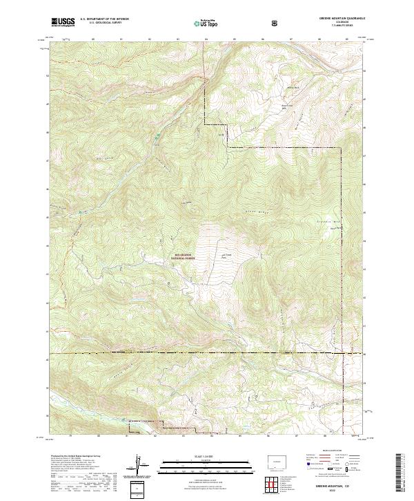
2022 Map of Greenie Mountain
USGS Topo · Published 2022About this map
The Rio Grande National Forest dominates this landscape, characterized by a complex network of high-elevation parks and deep drainages. In the south, the Alamosa River cuts through the terrain near The Canyon, while further north, the prominent peak of Greenie Mtn stands near Horse Park. The geography is defined by its water system, with Cat Creek, Willow Cr, and the three forks of Rock Cr carving distinct paths through the forest. Notable landmarks such as Bishop Rock and Lion Point offer specific points of orientation within the rugged topography.
Find a feature on this map
46 named features on this map. Tap any name to fly to it.
Don’t see what you’re looking for? This feature index may not catch every label — zoom into the map to look around manually.
Map Details
Editions of this 2022 Greenie Mountain Map
This is the sole edition of this map. No revisions or reprints were ever made.
Other maps of this area

1915 · Del Norte
USGS Topo · 1:125,000

1917 · Del Norte
USGS Topo · 1:125,000

1922 · Conejos
USGS Topo · 1:125,000

1945 · Durango
USGS Topo · 1:250,000

1953 · Durango
USGS Topo · 1:250,000

1954 · Durango
USGS Topo · 1:250,000

1961 · Durango
USGS Topo · 1:250,000

1963 · Durango
USGS Topo · 1:250,000

1964 · Monte Vista
USGS Topo · 1:24,000

1966 · Durango
USGS Topo · 1:250,000