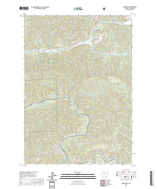
2024 Map of Greenleaf
USGS Topo · Published 2024About this map
The Siuslaw River winds through the central portion of this Lane County landscape, defining a network of steep drainages and timbered ridges. Near the community of Greenleaf, the confluence of Lake Creek and McVey Creek highlights the valley's reliance on these primary watercourses for early transport and settlement. Much of the western and northern terrain is managed as the Siuslaw National Forest, where high points like Bailey Ridge and Walker Point overlook a complex watershed including San Antone Creek and Schoolhouse Creek. Historians and researchers can trace the path of Old Stagecoach Rd as it follows the river's curves toward the south, passing the Linslaw Cem near the junction with Richardson Upriver Rd. This modern survey documents the persistent topography of the Coast Range, where family names are still preserved in labels like Johnston Creek and Nelson Creek.
Find a feature on this map
48 named features on this map. Tap any name to fly to it.
Don’t see what you’re looking for? This feature index may not catch every label — zoom into the map to look around manually.
Map Details
Editions of this 2024 Greenleaf Map
This is the sole edition of this map. No revisions or reprints were ever made.
Other maps of this area

1918 · Mapleton
USGS Topo · 1:48,000

1919 · Earl
USGS Topo · 1:48,000

1940 · Mapleton
USGS Topo · 1:62,500

1941 · Blachly
USGS Topo · 1:62,500

1942 · Blachly
USGS Topo · 1:62,500

1942 · Roman Nose Mtn
USGS Topo · 1:62,500

1943 · Goodwin Peak
USGS Topo · 1:62,500

1945 · Mapleton
USGS Topo · 1:62,500

1945 · Roman Nose Mtn
USGS Topo · 1:62,500

1953 · Salem
USGS Topo · 1:250,000