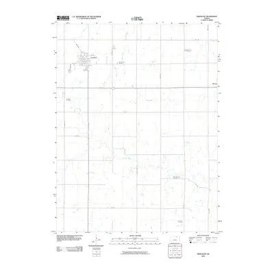
2009 Map of Greenleaf
USGS Topo · Published 2009About this map
The town of Greenleaf stands as a central hub in this Washington County landscape, defined by a grid of streets including 1st St, 2nd St, and the tellingly named Rail Blvd. The surrounding countryside is primarily agricultural, yet it is deeply punctuated by the spiritual and ancestral markers of the community. Five distinct burial grounds, including Sacred Heart Cemetery near the town center and Maplewood Cemetery to the northeast, provide significant touchpoints for genealogical research.
Find a feature on this map
31 named features on this map. Tap any name to fly to it.
Don’t see what you’re looking for? This feature index may not catch every label — zoom into the map to look around manually.
Map Details
Editions of this 2009 Greenleaf Map
This is the sole edition of this map. No revisions or reprints were ever made.
Other maps of this area

1889 · Marysville
USGS Topo · 1:125,000

1893 · Washington
USGS Topo · 1:125,000

1894 · Marysville
USGS Topo · 1:125,000

1955 · Manhattan
USGS Topo · 1:250,000

1956 · Manhattan
USGS Topo · 1:250,000

1957 · Manhattan
USGS Topo · 1:250,000

1966 · Washington
USGS Topo · 1:24,000

1966 · Hanover SE
USGS Topo · 1:24,000

1966 · Hanover SW
USGS Topo · 1:24,000
1968 · Linn
USGS Topo · 1:24,000