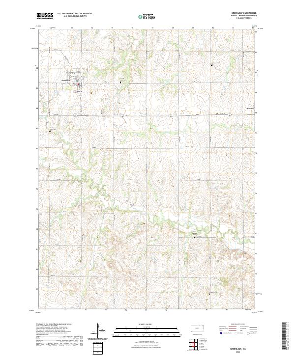
2022 Map of Greenleaf
USGS Topo · Published 2022About this map
Greenleaf anchors the northwest corner of this Washington County landscape, where the local grid includes distinctive street names such as Rail Blvd, Commercial St, and Main ST. The agricultural character of the region is evident in the systematic road network and the presence of Ron Mill along 10th Rd. Rural life in this part of Kansas is well-documented through several community burial grounds, including Sacred Heart Cem near the town center and more isolated sites like Round Grove Cem and Saint Boniface Cem. In the east, the settlement of Barnes sits near the headwaters of Mercer Cr. The terrain is defined by a series of drainage systems, with Coon Cr and Camp Cr cutting across the central sections of the township, illustrating the relationship between the natural watercourses and the section-line roads that govern the movement of people and goods across the plains.
Find a feature on this map
45 named features on this map. Tap any name to fly to it.
Don’t see what you’re looking for? This feature index may not catch every label — zoom into the map to look around manually.
Map Details
Editions of this 2022 Greenleaf Map
This is the sole edition of this map. No revisions or reprints were ever made.
Other maps of this area

1889 · Marysville
USGS Topo · 1:125,000

1893 · Washington
USGS Topo · 1:125,000

1894 · Marysville
USGS Topo · 1:125,000

1955 · Manhattan
USGS Topo · 1:250,000

1956 · Manhattan
USGS Topo · 1:250,000

1957 · Manhattan
USGS Topo · 1:250,000

1966 · Washington
USGS Topo · 1:24,000

1966 · Hanover SE
USGS Topo · 1:24,000

1966 · Hanover SW
USGS Topo · 1:24,000
1968 · Linn
USGS Topo · 1:24,000