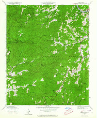
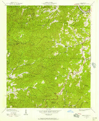
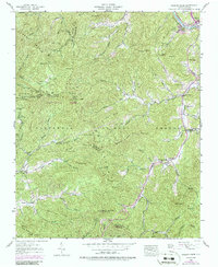
1940 Map of Greens Creek
USGS Topo · Published 1964About this map
Dillsboro sits at the northern edge of this rugged landscape where the Southern Railway meets the Tuckasegee River. Recorded in 1940, the terrain is defined by the sharp ridges of the Nantahala National Forest and the intersecting boundaries of Swain, Jackson, and Macon Counties. The settlement pattern follows the narrow creek valleys, where small communities established essential institutions like the Greens Creek School and Savannah Church. A prominent Lookout Tower atop Cowee Bald overlooks the interior peaks, including Wesser Gap and Wolf Knob. This era shows a high density of rural infrastructure, with numerous family-named landmarks like Leatherman Gap and Bradley Buff alongside smaller hamlets such as Gay and Pumpkintown. The road network consists primarily of the primary corridors of U.S. 19-23 and N.C. 107, connecting these isolated valley farms to the larger regional trade hubs.
Find a feature on this map
81 named features on this map. Tap any name to fly to it.
Don’t see what you’re looking for? This feature index may not catch every label — zoom into the map to look around manually.
Map Details
Editions of this 1940 Greens Creek Map
6 editions found
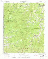
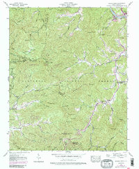
Other maps of this area

1891 · Cowee
USGS Topo · 1:125,000

1897 · Cowee
USGS Topo · 1:125,000

1907 · Cowee
USGS Topo · 1:125,000

1933 · Bryson
USGS Topo · 1:62,500

1935 · Franklin
USGS Topo · 1:24,000

1935 · Cullowhee
USGS Topo · 1:24,000

1935 · Addie
USGS Topo · 1:24,000

1935 · Glenville
USGS Topo · 1:24,000

1935 · Corbin Knob
USGS Topo · 1:24,000

1936 · Greens Creek
USGS Topo · 1:24,000