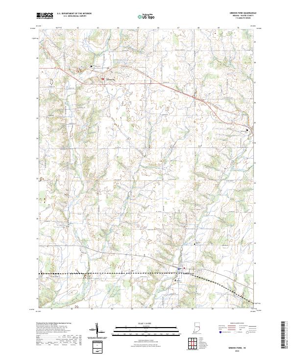
2022 Map of Greens Fork
USGS Topo · Published 2022About this map
The town of Economy and the village of Greens Fork anchor this rural landscape in Wayne County, where modern recreation paths now trace the corridors of vanished rail lines. The Cardinal Greenway Trl cuts diagonally across the northern townships, following a historical transport route past the Economy Cem toward the headwaters of Martindale Cr. The terrain is defined by a dense network of small waterways, including Wash Br, Morgan Cr, and Economy Run, which drain the agricultural land into the larger Greens Fork branch.
Find a feature on this map
69 named features on this map. Tap any name to fly to it.
Don’t see what you’re looking for? This feature index may not catch every label — zoom into the map to look around manually.
Map Details
Editions of this 2022 Greens Fork Map
This is the sole edition of this map. No revisions or reprints were ever made.
Other maps of this area

1915 · New Paris
USGS Topo · 1:48,000

1916 · Winchester
USGS Topo · 1:48,000

1918 · Winchester
USGS Topo · 1:62,500

1918 · New Paris
USGS Topo · 1:62,500

1943 · Winchester
USGS Topo · 1:62,500

1953 · Cincinnati
USGS Topo · 1:250,000

1953 · Muncie
USGS Topo · 1:250,000

1956 · Muncie
USGS Topo · 1:250,000

1957 · Cincinnati
USGS Topo · 1:250,000

1960 · Carlos
USGS Topo · 1:24,000