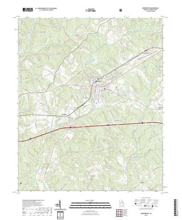
2024 Map of Greensboro
USGS Topo · Published 2024About this map
Greensboro serves as the focal point of this Greene County landscape, dominated by the intersection of local history and modern infrastructure. The Greene County Courthouse anchors the town center, while surrounding residential streets lead toward landmarks like the Greensboro City Cem and Cemetery Hill. The geography is defined by a dense network of waterways, including Richland Creek and Town Creek, which carve through the terrain south of the Oconee National Forest. Small communities like Thurston and Veazey dot the outlying areas, connected by historical routes such as Stagecoach Rd and Lick Skillet Rd. This contemporary survey also highlights the religious and genealogical significance of the region, specifically marking the Walker United Methodist Church Cem and the distant Ayers Cem, reflecting the area's deep-rooted community foundations amidst its natural rolling hydrology.
Find a feature on this map
100 named features on this map. Tap any name to fly to it.
Don’t see what you’re looking for? This feature index may not catch every label — zoom into the map to look around manually.
Map Details
Editions of this 2024 Greensboro Map
This is the sole edition of this map. No revisions or reprints were ever made.
Other maps of this area

1953 · Athens
USGS Topo · 1:250,000

1958 · Athens
USGS Topo · 1:250,000

1959 · Athens
USGS Topo · 1:250,000

1963 · Athens
USGS Topo · 1:250,000

1965 · Woodville
USGS Topo · 1:24,000

1965 · Union Point
USGS Topo · 1:24,000

1972 · Penfield
USGS Topo · 1:24,000

1972 · Liberty
USGS Topo · 1:24,000

1972 · Buckhead
USGS Topo · 1:24,000

1972 · Harmony
USGS Topo · 1:24,000