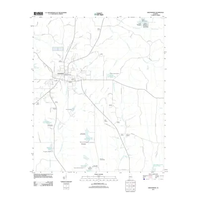
2011 Map of Greensboro
USGS Topo · Published 2011About this map
Greensboro serves as the central hub of this West Alabama landscape, where residential streets like Main St and 1st St extend from the town center. The area is dense with family and community burial grounds, including the large Oakwood Cemetery and Greensboro Cemetery within the city limits, while more isolated sites such as Redick Cemetery, Burton Cemetery, and Saint Marys Cemetery are scattered throughout the rural periphery.
Find a feature on this map
95 named features on this map. Tap any name to fly to it.
Don’t see what you’re looking for? This feature index may not catch every label — zoom into the map to look around manually.
Map Details
Editions of this 2011 Greensboro Map
This is the sole edition of this map. No revisions or reprints were ever made.
Other maps of this area

1953 · Montgomery
USGS Topo · 1:250,000

1956 · Montgomery
USGS Topo · 1:250,000

1957 · Montgomery
USGS Topo · 1:250,000

1979 · Scott Station
USGS Topo · 1:24,000

1979 · Morgan Springs
USGS Topo · 1:24,000

1979 · Greensboro
USGS Topo · 1:24,000
1980 · Casemore
USGS Topo · 1:24,000

1980 · Ingram
USGS Topo · 1:24,000
1980 · Newbern
USGS Topo · 1:24,000
1980 · Sawyerville
USGS Topo · 1:24,000