
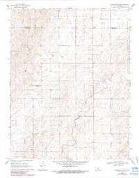
1969 Map of Greensburg NW
USGS Topo · Published 1971About this map
Rattlesnake Creek meanders through the central plains of this Kansas landscape, crossing through the townships of Butler, Martin, and Garfield. This late 1960s survey documents a region defined by agricultural sections and growing energy extraction, most notably the Falick South Oil Field. The landscape is etched with a network of pipelines and dotted with numerous drill holes and an active Pumping Station, indicating the industrial character of the rural economy. For family historians, the map provides precise locations for the Bethel Cem and McKinley Cem, which serve as small but vital landmarks in an otherwise open, sectioned environment. The boundary between Edwards and Kiowa counties runs across the northern portion of the sheet, dividing the high plains terrain into distinct administrative and land-use blocks.
Find a feature on this map
16 named features on this map. Tap any name to fly to it.
Don’t see what you’re looking for? This feature index may not catch every label — zoom into the map to look around manually.
Map Details
Editions of this 1969 Greensburg NW Map
2 editions found
Other maps of this area

1889 · Kinsley
USGS Topo · 1:125,000

1892 · Kinsley
USGS Topo · 1:125,000

1892 · Spearville
USGS Topo · 1:125,000

1894 · Spearville
USGS Topo · 1:125,000

1894 · Kinsley
USGS Topo · 1:125,000

1955 · Pratt
USGS Topo · 1:250,000

1959 · Pratt
USGS Topo · 1:250,000

1969 · Bucklin NE
USGS Topo · 1:24,000

1969 · Bucklin SE
USGS Topo · 1:24,000
1969 · Greensburg
USGS Topo · 1:24,000