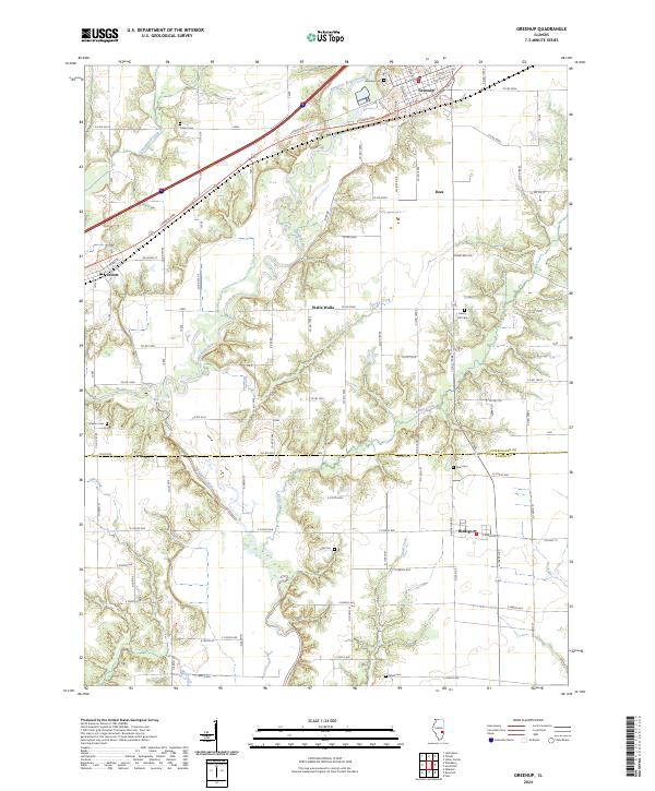
2024 Map of Greenup
USGS Topo · Published 2024About this map
The Embarras River carves a winding path through the center of this terrain, anchoring a landscape where rural settlements like Walla Walla and Dees sit alongside the larger hubs of Greenup and Jewett. Transportation history is layered throughout the region, with the historic National Trails Dr and US Rte 40 running parallel to the Cumberland Rd in the north. This network suggests a long-standing corridor of movement across the prairie, connecting these small communities to the wider state.
Find a feature on this map
55 named features on this map. Tap any name to fly to it.
Don’t see what you’re looking for? This feature index may not catch every label — zoom into the map to look around manually.
Map Details
Editions of this 2024 Greenup Map
This is the sole edition of this map. No revisions or reprints were ever made.
Other maps of this area

1933 · Toledo
USGS Topo · 1:62,500

1934 · Mattoon
USGS Topo · 1:62,500

1937 · Mattoon
USGS Topo · 1:62,500

1938 · Toledo
USGS Topo · 1:62,500

1940 · Greenup
USGS Topo · 1:62,500

1943 · Greenup
USGS Topo · 1:62,500

1953 · Teutopolis
USGS Topo · 1:62,500

1958 · Decatur
USGS Topo · 1:250,000

1961 · Decatur
USGS Topo · 1:250,000
1984 · Toledo
USGS Topo · 1:24,000