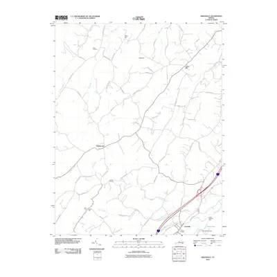
2010 Map of Greenville
USGS Topo · Published 2010About this map
Greenville and Middlebrook serve as primary nodes in this Augusta County landscape, where the Shenandoah Valley's agricultural and industrial history is written in the names of its roads and waterways. The map reveals a dense network of country lanes such as Baylor Mill Rd, Mclures Mill Rd, and Stover School Rd, which highlight the importance of early processing and education in these rural communities. Along the southwestern reaches, the Harris Mine and Allen Mine point to local mineral extraction, while the presence of Glebe Cemetery, Oak Hill Cemetery, and Greenville Cemetery provides significant points of reference for genealogical research.
Find a feature on this map
63 named features on this map. Tap any name to fly to it.
Don’t see what you’re looking for? This feature index may not catch every label — zoom into the map to look around manually.
Map Details
Editions of this 2010 Greenville Map
This is the sole edition of this map. No revisions or reprints were ever made.
Other maps of this area

1894 · Staunton
USGS Topo · 1:125,000

1894 · Lexington
USGS Topo · 1:125,000

1932 · Lexington
USGS Topo · 1:48,000

1936 · Vesuvius
USGS Topo · 1:48,000

1937 · Lexington
USGS Topo · 1:62,500

1941 · Vesuvius
USGS Topo · 1:62,500

1943 · Craigsville
USGS Topo · 1:62,500

1944 · Staunton
USGS Topo · 1:62,500

1945 · Craigsville
USGS Topo · 1:62,500

1947 · Staunton
USGS Topo · 1:62,500