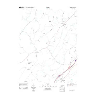
2013 Map of Greenville
USGS Topo · Published 2013About this map
Greenville and Middlebrook anchor this portion of Augusta County, where the landscape is defined by a dense network of watercourses and agricultural properties. Small settlements like Arbor Hill and Stony Hill sit among the headwaters of numerous creeks, including Folly Mills Cr and Smoky Row Cr, illustrating a historic land use pattern centered on upland farming and riparian access. The topography is punctuated by the prominent height of Sugarloaf, while agricultural life is represented by specific sites such as Wrenn's Turkey Farm and Sinking Springs Farm. In the southeast, the confluence of the South River and Christians Cr near Wallace Lake highlights the importance of drainage to the local economy. This survey documents the modern road network, like Stone Branch Rd and Baylor Mill Rd, overlaid upon a rural framework that has changed little in its fundamental distribution of family-named landmarks and water-oriented hamlets.
Find a feature on this map
86 named features on this map. Tap any name to fly to it.
Don’t see what you’re looking for? This feature index may not catch every label — zoom into the map to look around manually.
Map Details
Editions of this 2013 Greenville Map
This is the sole edition of this map. No revisions or reprints were ever made.
Other maps of this area

1894 · Staunton
USGS Topo · 1:125,000

1894 · Lexington
USGS Topo · 1:125,000

1932 · Lexington
USGS Topo · 1:48,000

1936 · Vesuvius
USGS Topo · 1:48,000

1937 · Lexington
USGS Topo · 1:62,500

1941 · Vesuvius
USGS Topo · 1:62,500

1943 · Craigsville
USGS Topo · 1:62,500

1944 · Staunton
USGS Topo · 1:62,500

1945 · Craigsville
USGS Topo · 1:62,500

1947 · Staunton
USGS Topo · 1:62,500