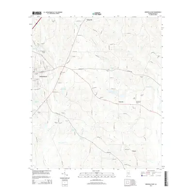
2014 Map of Greenville East
USGS Topo · Published 2014About this map
Greenville serves as the focal point for this Butler County survey, reflecting the city’s eastward expansion and infrastructure during the mid-2010s. The landscape is characterized by a high density of aviation and water features, including the Mac Crenshaw Memorial Airport and smaller airstrips like Sells Airport. For genealogists and local historians, the map is a significant record of rural burial sites, documenting Pioneer Cem, Mt Zion Cem, Ebenezer Cem, and Hartley Cem among others. The drainage patterns of Persimmon Cr and Pigeon Cr define the rolling terrain, while numerous small reservoirs and ponds such as Luckie Pond and Lake Tanner dot the countryside. Outlying communities like Nashville, Glasgow, and Spring Hill are connected by a network of local roads including Honoraville Rd and Old Central Rd, illustrating the transition from urban center to the timber and agricultural lands of central Alabama.
Find a feature on this map
95 named features on this map. Tap any name to fly to it.
Don’t see what you’re looking for? This feature index may not catch every label — zoom into the map to look around manually.
Map Details
Editions of this 2014 Greenville East Map
This is the sole edition of this map. No revisions or reprints were ever made.
Other maps of this area

1953 · Andalusia
USGS Topo · 1:250,000

1957 · Andalusia
USGS Topo · 1:250,000

1971 · Greenville West
USGS Topo · 1:24,000

1971 · Pigeon Creek
USGS Topo · 1:24,000

1971 · Fort Deposit
USGS Topo · 1:24,000

1971 · Honoraville
USGS Topo · 1:24,000

1971 · Fort Dale
USGS Topo · 1:24,000

1971 · Moodys Crossroads
USGS Topo · 1:24,000

1971 · Greenville East
USGS Topo · 1:24,000

1971 · Danielsville
USGS Topo · 1:24,000