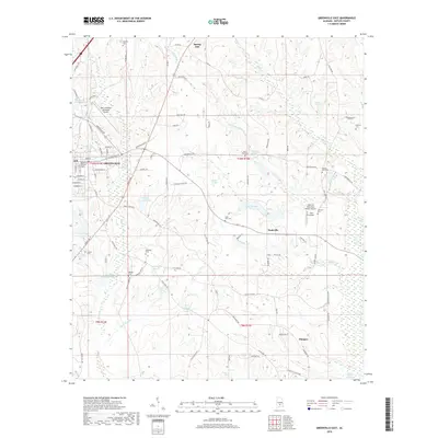
2018 Map of Greenville East
USGS Topo · Published 2018About this map
The eastern edges of Greenville anchor this landscape, where the residential grid of Walnut St and E Commerce St transitions into the rolling terrain of eastern Butler County. The area is defined by a dense network of water bodies and small drainage basins, including Luckie Pond, Stirling Hamilton Lake, and the expansive Pigeon Creek Swamp to the southeast. Aviation is a notable part of the local infrastructure, with the Mac Crenshaw Memorial Airport and smaller facilities like Sells Airport and the Heart of Dixie Aero Estates Airport dotting the map. This 2018 survey provides significant genealogical detail through several burial sites such as Pioneer Cem and Saint Paul Cem, alongside smaller rural communities like Mashville and Glasgow that are connected by a web of county roads and named branches like Fourmile Mill Br.
Find a feature on this map
101 named features on this map. Tap any name to fly to it.
Don’t see what you’re looking for? This feature index may not catch every label — zoom into the map to look around manually.
Map Details
Editions of this 2018 Greenville East Map
This is the sole edition of this map. No revisions or reprints were ever made.
Other maps of this area

1953 · Andalusia
USGS Topo · 1:250,000

1957 · Andalusia
USGS Topo · 1:250,000

1971 · Greenville West
USGS Topo · 1:24,000

1971 · Pigeon Creek
USGS Topo · 1:24,000

1971 · Fort Deposit
USGS Topo · 1:24,000

1971 · Honoraville
USGS Topo · 1:24,000

1971 · Fort Dale
USGS Topo · 1:24,000

1971 · Moodys Crossroads
USGS Topo · 1:24,000

1971 · Greenville East
USGS Topo · 1:24,000

1971 · Danielsville
USGS Topo · 1:24,000