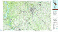
1991 Map of Greenville
USGS Topo · Published 1991About this map
The Upstate region of South Carolina is defined here by the rapid convergence of urban growth and massive water management projects in the late twentieth century. Greenville serves as the central hub, surrounded by a ring of developing communities like Mauldin, Simpsonville, and Taylors. The western edge of the map is dominated by the sprawling waters of Hartwell Lake, Lake Keowee, and Lake Jocassee, illustrating how the landscape was transformed to support regional power and recreation.
Find a feature on this map
145 named features on this map. Tap any name to fly to it.
Don’t see what you’re looking for? This feature index may not catch every label — zoom into the map to look around manually.
Map Details
Editions of this 1991 Greenville Map
This is the sole edition of this map. No revisions or reprints were ever made.
Other maps of this area

1886 · Walhalla
USGS Topo · 1:125,000

1888 · Pickens
USGS Topo · 1:125,000

1891 · Cowee
USGS Topo · 1:125,000

1891 · Carnesville
USGS Topo · 1:125,000

1892 · Walhalla
USGS Topo · 1:125,000

1892 · Abbeville
USGS Topo · 1:125,000

1893 · Elberton
USGS Topo · 1:125,000

1894 · Pickens
USGS Topo · 1:125,000

1896 · Walhalla
USGS Topo · 1:125,000

1897 · Cowee
USGS Topo · 1:125,000