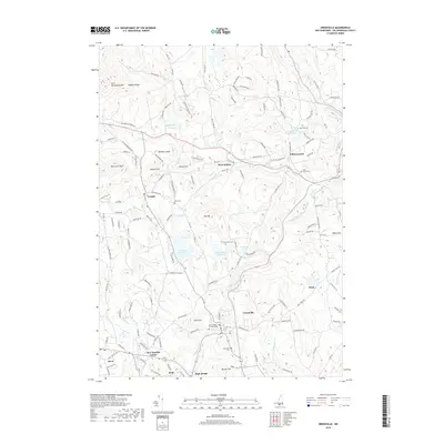
2018 Map of Greenville
USGS Topo · Published 2018About this map
New Ipswich Center and Greenville anchor this southern New Hampshire landscape, where the Souhegan River carves through a region defined by high ridges and family-named landmarks. The terrain rises sharply toward the northwest to the Wapack Range and Pack Monadnock Mtn, while the valleys are dotted with historic burial grounds like Vale End Cem and the Sacred Heart of Jesus Cem. Local history is preserved in the network of farm roads and settlements such as West Wilton and Temple. Several water management features, including the New Wilton Reservoir and King Brook Reservoir, illustrate how the drainage from the surrounding hills has been harnessed for the regional population. The map also traces various smaller hamlets like Bank and High Bridge, which provide specific points of interest for genealogical research in Hillsborough County.
Find a feature on this map
145 named features on this map. Tap any name to fly to it.
Don’t see what you’re looking for? This feature index may not catch every label — zoom into the map to look around manually.
Map Details
Editions of this 2018 Greenville Map
This is the sole edition of this map. No revisions or reprints were ever made.
Other maps of this area

1887 · Fitchburg
USGS Topo · 1:62,500

1889 · Fitchburg
USGS Topo · 1:62,500

1893 · Fitchburg
USGS Topo · 1:62,500

1893 · Groton
USGS Topo · 1:62,500

1900 · Peterboro
USGS Topo · 1:62,500

1906 · Milford
USGS Topo · 1:62,500

1931 · Groton
USGS Topo · 1:48,000

1931 · Fitchburg
USGS Topo · 1:48,000

1935 · Groton
USGS Topo · 1:62,500

1935 · Fitchburg
USGS Topo · 1:62,500