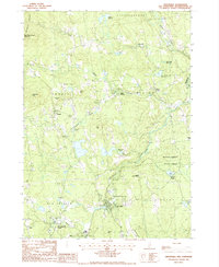
1987 Map of Greenville
USGS Topo · Published 1987About this map
The Souhegan River cuts a prominent path through this corner of Hillsborough County, anchoring the town of Greenville and its surrounding hill country. This 1980s landscape reflects a mix of established village centers and upland forest, with the Wapack Range rising in the northwest near Pack Monadnock Mountain. The settlement pattern is defined by traditional clusters such as Wilton Center, West Wilton, and New Ipswich Center, while the industrial history of the region is etched into the terrain through numerous excavations including a Gravel Pit and Sandpit sites.
Find a feature on this map
43 named features on this map. Tap any name to fly to it.
Don’t see what you’re looking for? This feature index may not catch every label — zoom into the map to look around manually.
Map Details
Editions of this 1987 Greenville Map
This is the sole edition of this map. No revisions or reprints were ever made.
Other maps of this area

1887 · Fitchburg
USGS Topo · 1:62,500

1889 · Fitchburg
USGS Topo · 1:62,500

1893 · Fitchburg
USGS Topo · 1:62,500

1893 · Groton
USGS Topo · 1:62,500

1900 · Peterboro
USGS Topo · 1:62,500

1906 · Milford
USGS Topo · 1:62,500

1931 · Groton
USGS Topo · 1:48,000

1931 · Fitchburg
USGS Topo · 1:48,000

1935 · Groton
USGS Topo · 1:62,500

1935 · Fitchburg
USGS Topo · 1:62,500