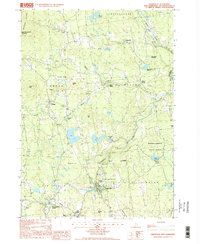
1997 Map of Greenville
USGS Topo · Published 1998About this map
Souhegan River winds through the hills of southern New Hampshire, defining the industrial and residential core of Greenville. This 1990s provisional survey illustrates a landscape shaped by both the Wapack Range and historical water management, featuring both the Old Wilton Reservoir and the New Wilton Reservoir. Smaller settlements like West Wilton and Temple are connected by winding country roads, while the presence of several Cem (cemeteries) and a Town Cor Mon (town corner monument) provide valuable points of reference for local historians.
Find a feature on this map
44 named features on this map. Tap any name to fly to it.
Don’t see what you’re looking for? This feature index may not catch every label — zoom into the map to look around manually.
Map Details
Editions of this 1997 Greenville Map
This is the sole edition of this map. No revisions or reprints were ever made.
Other maps of this area

1887 · Fitchburg
USGS Topo · 1:62,500

1889 · Fitchburg
USGS Topo · 1:62,500

1893 · Fitchburg
USGS Topo · 1:62,500

1893 · Groton
USGS Topo · 1:62,500

1900 · Peterboro
USGS Topo · 1:62,500

1906 · Milford
USGS Topo · 1:62,500

1931 · Groton
USGS Topo · 1:48,000

1931 · Fitchburg
USGS Topo · 1:48,000

1935 · Groton
USGS Topo · 1:62,500

1935 · Fitchburg
USGS Topo · 1:62,500