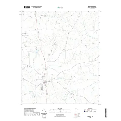
2020 Map of Greenville
USGS Topo · Published 2020About this map
Greenville serves as the focal point of this Meriwether County survey, anchored by the Meriwether County Courthouse and the nearby West Georgia Technical College. The surrounding landscape is defined by a dense network of local routes such as Halls Mill Rd and James Store Rd, which connect the county seat to outlying communities like Allie. The area is notably dense with commemorative and religious sites, including the Fellowship Cem and the Greenville Presbyterian Church Cem, providing a clear map for genealogical research. Waterways like Red Oak Cr and Walnut Cr drain the undulating terrain, punctuated by community landmarks such as American Legion Lake and Perkerson Veterans Club Lake. This digital edition preserves the modern road alignments and local geography as they appeared in the early 21st century.
Find a feature on this map
87 named features on this map. Tap any name to fly to it.
Don’t see what you’re looking for? This feature index may not catch every label — zoom into the map to look around manually.
Map Details
Editions of this 2020 Greenville Map
This is the sole edition of this map. No revisions or reprints were ever made.
Other maps of this area

1907 · Talbotton
USGS Topo · 1:125,000

1934 · Warm Springs
USGS Topo · 1:62,500

1936 · Warm Springs
USGS Topo · 1:62,500

1953 · Atlanta
USGS Topo · 1:250,000

1955 · Phenix City
USGS Topo · 1:250,000

1957 · Phenix City
USGS Topo · 1:250,000

1957 · Atlanta
USGS Topo · 1:250,000

1958 · Phenix City
USGS Topo · 1:250,000

1958 · Atlanta
USGS Topo · 1:250,000

1964 · Grantville
USGS Topo · 1:24,000