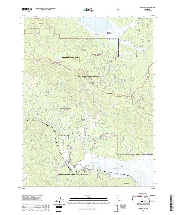
2021 Map of Greenville
USGS Topo · Published 2021About this map
Greenville sits at the foot of North Canyon in the northern Sierras, serving as a gateway to the high timberlands of the Plumas National Forest and Lassen National Forest. The landscape is defined by the broad, fertile expanse of Indian Valley to the south and the high-altitude Mountain Meadows to the north, which is largely occupied by the Mountain Meadows Reservoir. Local history is anchored by the Greenville District Cem and the thermal waters of the Indian Valley Hot Springs and Spirit Springs along the valley floor. Steep ridges like Keddie Ridge rise sharply from the valley, punctuated by high-country features such as Keddie Peak and Deerheart Lake. The road network, including the Old Haun Rd and Greenville Wolf Creek Rd, follows the natural contours of the canyons and creek beds that have supported ranching and resource extraction in this part of Plumas County for generations.
Find a feature on this map
54 named features on this map. Tap any name to fly to it.
Don’t see what you’re looking for? This feature index may not catch every label — zoom into the map to look around manually.
Map Details
Editions of this 2021 Greenville Map
This is the sole edition of this map. No revisions or reprints were ever made.
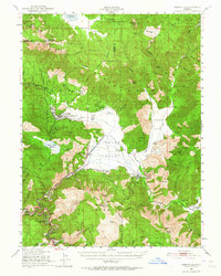
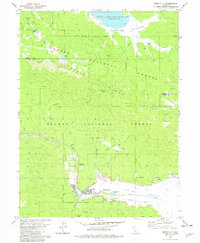
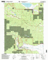
Historical Maps of Greenville Through Time
4 maps found