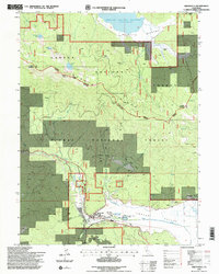
1994 Map of Greenville
USGS Topo · Published 1998About this map
Indian Valley serves as a geographic anchor for this 1990s-era study of the Sierra Nevada foothills, where the settlement of Greenville sits at the intersection of timber-rich national forests and historic mining claims. The landscape is defined by the high ridge of Keddie Ridge and the Eagle Lake Mount Hough range, shielding the meadows from the northern expanse of the Mountain Meadows Reservoir. This map documents a transitional period in the local economy, where industrial sites like the New York Mine and Indian Valley Mine share space with modern infrastructure such as the Indian Valley Hospital Heliport and the Indian Mission. Genealogists and historians will find value in the detailed plotting of local landmarks, including the Cemetery south of town, the High Sch, and the Stroing Ranch to the northeast. Water remains the primary shaper of the valley, from the Indian Valley Hot Springs to the Peter Lassen Springs Marker, commemorating the area’s early frontier routes.
Find a feature on this map
41 named features on this map. Tap any name to fly to it.
Don’t see what you’re looking for? This feature index may not catch every label — zoom into the map to look around manually.
Map Details
Editions of this 1994 Greenville Map
2 editions found

Other maps of this area

1886 · Honey Lake
USGS Topo · 1:250,000

1886 · Lassen Peak
USGS Topo · 1:250,000

1891 · Honey Lake
USGS Topo · 1:250,000

1892 · Lassen Peak
USGS Topo · 1:250,000

1893 · Honey Lake
USGS Topo · 1:250,000

1894 · Lassen Peak
USGS Topo · 1:250,000
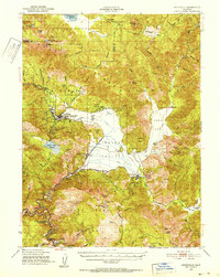
1950 · Greenville
USGS Topo · 1:62,500
1955 · Westwood
USGS Topo · 1:62,500
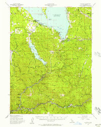
1955 · Almanor
USGS Topo · 1:62,500

1955 · Westwood
USGS Topo · 1:250,000