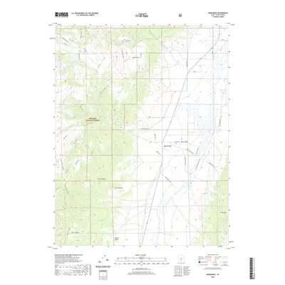
2020 Map of Greenwich
USGS Topo · Published 2020About this map
Grass Valley serves as a central agricultural corridor in this high-altitude landscape, where the settlement of Greenwich sits near the base of Monroe Mountain. The 2020 geography highlights a complex irrigation and water management system essential for mountain ranching, featuring the Koosharem Canal and the Otter Cr drainage. Significant water storage is provided by the Upper Box Cr Reservoir and Lower Box Cr Reservoir within the bounds of the Fishlake National Forest.
Find a feature on this map
46 named features on this map. Tap any name to fly to it.
Don’t see what you’re looking for? This feature index may not catch every label — zoom into the map to look around manually.
Map Details
Editions of this 2020 Greenwich Map
This is the sole edition of this map. No revisions or reprints were ever made.
Other maps of this area

1885 · Beaver
USGS Topo · 1:250,000

1885 · Fish Lake
USGS Topo · 1:250,000

1896 · Fish Lake
USGS Topo · 1:250,000

1940 · Monroe
USGS Topo · 1:62,500

1944 · Monroe
USGS Topo · 1:62,500

1945 · Marysvale
USGS Topo · 1:62,500

1947 · Marysvale
USGS Topo · 1:62,500

1953 · Richfield
USGS Topo · 1:250,000

1956 · Salina
USGS Topo · 1:250,000

1958 · Richfield
USGS Topo · 1:250,000