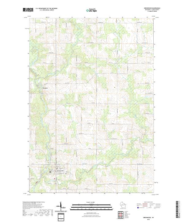
2022 Map of Greenwood
USGS Topo · Published 2022About this map
The Black River flows southward through Clark County, anchoring the settlement of Greenwood and the northern community of Hemlock. This 2022 survey detail shows a landscape defined by its river-valley drainage systems, including the Popple River, Beaver Cr, and Gile Cr. The street grid of Greenwood is clearly delineated, showing civic essentials like the Po (Post Office) and the Greenwood City Cem, alongside Saint Marys Cem just to the east. Transportation patterns reflect a mix of historic rail-aligned corridors like Depot St and a rigid township road system. Numerous family-named roads and rural routes such as Sladich Rd, Hinker Rd, and Maple Center RD provide a high degree of local geographic resolution. The map captures the transition from the concentrated town center into the surrounding agricultural and wooded plots that define this central Wisconsin region.
Find a feature on this map
65 named features on this map. Tap any name to fly to it.
Don’t see what you’re looking for? This feature index may not catch every label — zoom into the map to look around manually.
Map Details
Editions of this 2022 Greenwood Map
This is the sole edition of this map. No revisions or reprints were ever made.
Other maps of this area

1953 · Neillsville
USGS Topo · 1:62,500

1953 · Abbotsford
USGS Topo · 1:48,000

1953 · Owen
USGS Topo · 1:48,000

1953 · Eau Claire
USGS Topo · 1:250,000

1954 · Granton
USGS Topo · 1:62,500

1958 · Eau Claire
USGS Topo · 1:250,000

1963 · Abbotsford
USGS Topo · 1:62,500

1963 · Owen
USGS Topo · 1:62,500

1964 · Eau Claire
USGS Topo · 1:250,000
1979 · Loyal East
USGS Topo · 1:24,000