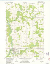
1982 Map of Greenwood
USGS Topo · Published 1982About this map
The Black River meanders through central Clark County, defining the valley where Greenwood serves as the primary hub of activity during the early 1980s. This land was organized under the townships of Warner, Beaver, Eaton, and Loyal, showing a landscape transitioned from early timber and rail to a stable dairy and agricultural economy. The Old Railroad Grade and the Soo Line trace the legacy of industrial transit that once dominated these river corridors.
Find a feature on this map
33 named features on this map. Tap any name to fly to it.
Don’t see what you’re looking for? This feature index may not catch every label — zoom into the map to look around manually.
Map Details
Editions of this 1982 Greenwood Map
This is the sole edition of this map. No revisions or reprints were ever made.
Other maps of this area

1953 · Neillsville
USGS Topo · 1:62,500

1953 · Abbotsford
USGS Topo · 1:48,000

1953 · Owen
USGS Topo · 1:48,000

1953 · Eau Claire
USGS Topo · 1:250,000

1954 · Granton
USGS Topo · 1:62,500

1958 · Eau Claire
USGS Topo · 1:250,000

1963 · Abbotsford
USGS Topo · 1:62,500

1963 · Owen
USGS Topo · 1:62,500

1964 · Eau Claire
USGS Topo · 1:250,000
1979 · Loyal East
USGS Topo · 1:24,000