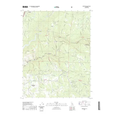
2021 Map of Greenwood
USGS Topo · Published 2021About this map
Greenwood stands as a focal point in this portion of the Sierra Nevada foothills, situated at the junction of Georgetown Rd and Sliger Mine Rd. The settlement pattern is defined by its gold-mining heritage, with the Greenwood Pioneer Cem and numerous river bars along the North Fork American River and Middle Fork American River marking the landscape. Names like Sardine Bar, Maine Bar, Oregon Bar, and Cherokee Bar trace the historical activity along these riverbeds, where prospectors once worked the gravels.
Find a feature on this map
194 named features on this map. Tap any name to fly to it.
Don’t see what you’re looking for? This feature index may not catch every label — zoom into the map to look around manually.
Map Details
Editions of this 2021 Greenwood Map
This is the sole edition of this map. No revisions or reprints were ever made.
Other maps of this area

1888 · Smartsville
USGS Topo · 1:125,000

1891 · Sacramento
USGS Topo · 1:125,000

1891 · Colfax
USGS Topo · 1:125,000

1891 · Smartsville
USGS Topo · 1:125,000

1891 · Placerville
USGS Topo · 1:125,000

1892 · Sacramento
USGS Topo · 1:125,000

1892 · Placerville
USGS Topo · 1:125,000

1892 · Smartsville
USGS Topo · 1:125,000

1892 · Colfax
USGS Topo · 1:125,000

1893 · Placerville
USGS Topo · 1:125,000