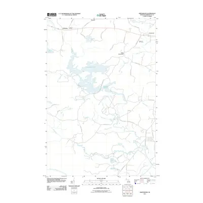
2011 Map of Greenwood
USGS Topo · Published 2011About this map
Greenwood Reservoir dominates the center of this landscape in the Upper Peninsula, its irregular shoreline creating a complex system of coves and inlets fed by Bell Creek. To the north, the small settlements of Clarksburg, Snowville, and Greenwood align along the primary east-west road corridor, mirroring the historic patterns of movement across Marquette County. Local history is anchored at the Clarksburg Cemetery, located just west of where County Rd CKC meets the main thoroughfare.
Find a feature on this map
49 named features on this map. Tap any name to fly to it.
Don’t see what you’re looking for? This feature index may not catch every label — zoom into the map to look around manually.
Map Details
Editions of this 2011 Greenwood Map
This is the sole edition of this map. No revisions or reprints were ever made.
Other maps of this area

1952 · Ishpeming
USGS Topo · 1:62,500

1952 · Ishpeming
USGS Topo · 1:24,000

1954 · Negaunee SW
USGS Topo · 1:24,000

1954 · Negaunee
USGS Topo · 1:62,500

1955 · Champion
USGS Topo · 1:24,000

1955 · Diorite
USGS Topo · 1:24,000

1955 · Greenwood
USGS Topo · 1:24,000

1955 · Republic
USGS Topo · 1:62,500

1955 · Republic
USGS Topo · 1:24,000

1955 · Republic SW
USGS Topo · 1:24,000