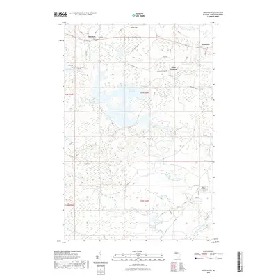
2019 Map of Greenwood
USGS Topo · Published 2019About this map
Clarksburg and Greenwood anchor this northern Michigan landscape, reflecting the region's deep industrial roots in the Upper Peninsula's iron country. The Iron Ore Heritage Trail cuts across the northern terrain, following the path of historic rail corridors that once served the mines of Marquette County. This 2019 survey documents the modern layout of these historic settlements alongside significant water features like the Greenwood Reservoir and the Middle Branch Escanaba River. Local history is anchored at the Clarksburg Cemetery, while the surrounding landscape is defined by its complex hydrography, including Black River Falls, Island Lake, and Lake Lory. The network of county roads, such as Greenwood Mine Rd, points to the heavy industrial activity that shaped the development of South Greenwood and the small clearing of Snowville.
Find a feature on this map
64 named features on this map. Tap any name to fly to it.
Don’t see what you’re looking for? This feature index may not catch every label — zoom into the map to look around manually.
Map Details
Editions of this 2019 Greenwood Map
This is the sole edition of this map. No revisions or reprints were ever made.
Other maps of this area

1952 · Ishpeming
USGS Topo · 1:62,500

1952 · Ishpeming
USGS Topo · 1:24,000

1954 · Negaunee SW
USGS Topo · 1:24,000

1954 · Negaunee
USGS Topo · 1:62,500

1955 · Champion
USGS Topo · 1:24,000

1955 · Diorite
USGS Topo · 1:24,000

1955 · Greenwood
USGS Topo · 1:24,000

1955 · Republic
USGS Topo · 1:62,500

1955 · Republic
USGS Topo · 1:24,000

1955 · Republic SW
USGS Topo · 1:24,000