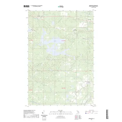
2023 Map of Greenwood
USGS Topo · Published 2023About this map
The Greenwood Reservoir dominates the center of this Marquette County landscape, serving as a focal point for the complex drainage of the Middle Branch Escanaba River and Bell Creek. In the northern portion of the map, the settlements of Clarksburg, Greenwood, and South Greenwood are linked by historical transportation corridors, including the Iron Ore Heritage Trl. This trail and nearby names like Greenwood Mine Rd hint at the region's deep connection to the Michigan iron mining industry.
Find a feature on this map
53 named features on this map. Tap any name to fly to it.
Don’t see what you’re looking for? This feature index may not catch every label — zoom into the map to look around manually.
Map Details
Editions of this 2023 Greenwood Map
This is the sole edition of this map. No revisions or reprints were ever made.
Other maps of this area

1952 · Ishpeming
USGS Topo · 1:62,500

1952 · Ishpeming
USGS Topo · 1:24,000

1954 · Negaunee SW
USGS Topo · 1:24,000

1954 · Negaunee
USGS Topo · 1:62,500

1955 · Champion
USGS Topo · 1:24,000

1955 · Diorite
USGS Topo · 1:24,000

1955 · Greenwood
USGS Topo · 1:24,000

1955 · Republic
USGS Topo · 1:62,500

1955 · Republic
USGS Topo · 1:24,000

1955 · Republic SW
USGS Topo · 1:24,000