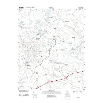
2011 Map of Greer
USGS Topo · Published 2011About this map
Victor Mills and the historic Apalachee Mill site anchor this industrial and residential portrait of the Piedmont region. The map reveals the intricate water network supporting these centers, including the South Tyger River and the Apalachee Mill Pond. The landscape is a dense network of suburban developments like Victor Heights and Wade Hampton Heights, illustrating the post-war expansion of Greer toward neighboring Duncan and Lyman.
Find a feature on this map
87 named features on this map. Tap any name to fly to it.
Don’t see what you’re looking for? This feature index may not catch every label — zoom into the map to look around manually.
Map Details
Editions of this 2011 Greer Map
This is the sole edition of this map. No revisions or reprints were ever made.
Other maps of this area

1907 · Saluda
USGS Topo · 1:125,000

1935 · Greer
USGS Topo · 1:48,000

1935 · Greenville
USGS Topo · 1:48,000

1938 · Greenville
USGS Topo · 1:62,500

1938 · Greer
USGS Topo · 1:62,500

1954 · Greenville
USGS Topo · 1:250,000

1955 · Knoxville
USGS Topo · 1:250,000

1957 · Greer
USGS Topo · 1:62,500

1957 · Greenville
USGS Topo · 1:62,500

1957 · Knoxville
USGS Topo · 1:250,000