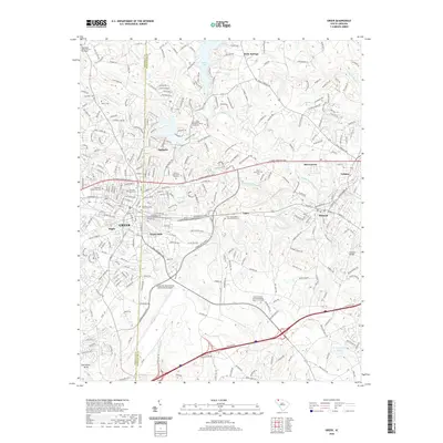
2020 Map of Greer
USGS Topo · Published 2020About this map
Greer stands as the central hub of this modern topography, situated along the Greenville Co and Spartanburg Co line. The map illustrates a landscape where industrial heritage and modern infrastructure meet, notably at Victor Mills and the sprawling Greenville Spartanburg International Airport to the south. Historically significant sites are scattered throughout the region, from the Washington Baptist Church in the northwest to the Woods Chapel United Methodist Church near the southern boundary. The drainage of the South Tyger River, Middle Tyger River, and N Tyger River dictates the local geography, feeding into Lyman Lake. Small communities like Apalache, Harveytown, and Maple provide context for the suburban expansion around the larger towns of Lyman and Duncan, while several cemeteries including Needmore Community Cem and Rector Cem offer vital data for those researching local family histories.
Find a feature on this map
280 named features on this map. Tap any name to fly to it.
Don’t see what you’re looking for? This feature index may not catch every label — zoom into the map to look around manually.
Map Details
Editions of this 2020 Greer Map
This is the sole edition of this map. No revisions or reprints were ever made.
Other maps of this area

1907 · Saluda
USGS Topo · 1:125,000

1935 · Greer
USGS Topo · 1:48,000

1935 · Greenville
USGS Topo · 1:48,000

1938 · Greenville
USGS Topo · 1:62,500

1938 · Greer
USGS Topo · 1:62,500

1954 · Greenville
USGS Topo · 1:250,000

1955 · Knoxville
USGS Topo · 1:250,000

1957 · Greer
USGS Topo · 1:62,500

1957 · Greenville
USGS Topo · 1:62,500

1957 · Knoxville
USGS Topo · 1:250,000