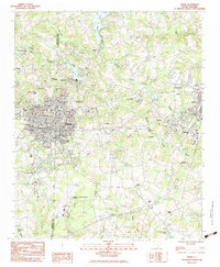
1983 Map of Greer
USGS Topo · Published 1983About this map
Greer and the textile-driven communities of the Upstate are captured here during a period of transition in the early 1980s. The landscape is defined by the industrial presence of Victor Mills and the nearby mill village of Apalache, while the dual tracks of the Southern Railway and Seaboard Coast Line emphasize the region's historic role as a transportation corridor. To the south, the expansion of the Greenville-Spartanburg Airport and the Duncan Correctional Center reflect the modern infrastructure developments of the era.
Find a feature on this map
57 named features on this map. Tap any name to fly to it.
Don’t see what you’re looking for? This feature index may not catch every label — zoom into the map to look around manually.
Map Details
Editions of this 1983 Greer Map
This is the sole edition of this map. No revisions or reprints were ever made.
Other maps of this area

1907 · Saluda
USGS Topo · 1:125,000

1935 · Greer
USGS Topo · 1:48,000

1935 · Greenville
USGS Topo · 1:48,000

1938 · Greenville
USGS Topo · 1:62,500

1938 · Greer
USGS Topo · 1:62,500

1954 · Greenville
USGS Topo · 1:250,000

1955 · Knoxville
USGS Topo · 1:250,000

1957 · Greer
USGS Topo · 1:62,500

1957 · Greenville
USGS Topo · 1:62,500

1957 · Knoxville
USGS Topo · 1:250,000