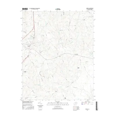
2016 Map of Gretna
USGS Topo · Published 2016About this map
Gretna serves as the primary hub of this Southside Virginia landscape, situated where the terrain begins to rise toward Brushy Mtn in the north. The area is defined by a dense network of watercourses, including the Stinking River and its numerous branches, such as W Fork Stinking River and N Fork Stinking River. This 2016 survey documents long-standing rural communities and crossroads that have persisted through generations, including Chalk Level, Natal, and Greenfield. Local heritage is anchored by sites like Vadens Mill and the Whitethorn Cem near Sonans, reflecting the agricultural and milling history of Pittsylvania County. The drainage patterns of Whitethorn Cr and Georges Cr illustrate the dissected nature of the Piedmont uplands, where roads like Scott Jacobs Memorial Dr and Ray Mill Rd follow the contours of the land between these small settlements.
Find a feature on this map
82 named features on this map. Tap any name to fly to it.
Don’t see what you’re looking for? This feature index may not catch every label — zoom into the map to look around manually.
Map Details
Editions of this 2016 Gretna Map
This is the sole edition of this map. No revisions or reprints were ever made.
Other maps of this area

1892 · Lynchburg
USGS Topo · 1:125,000

1921 · Chatham
USGS Topo · 1:48,000

1923 · Chatham
USGS Topo · 1:62,500

1947 · Roanoke
USGS Topo · 1:250,000

1951 · Altavista
USGS Topo · 1:62,500

1953 · Greensboro
USGS Topo · 1:250,000

1954 · Greensboro
USGS Topo · 1:250,000

1954 · Riceville
USGS Topo · 1:62,500

1956 · Gladys
USGS Topo · 1:62,500

1959 · Roanoke
USGS Topo · 1:250,000