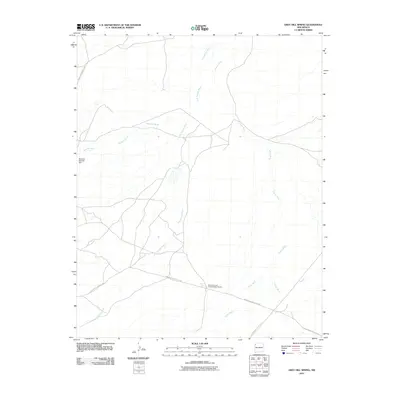
2010 Map of Grey Hill Spring
USGS Topo · Published 2010About this map
Whirlwind Lake Archaeological District defines the central landscape of this New Mexico quadrangle, marking a site of significant cultural and historical importance within the Grey Hill Spring area. The terrain is characterized by a complex network of seasonal drainages, including the prominent Salt Springs Wash, Coyote Wash, and Tocito Wash, which carve through the arid high desert. This 2010 survey highlights the intersection of modern transit and traditional lands, where Indian Service Route 89 and other local routes facilitate travel across the Navajo Nation. Water management remains a critical feature of the region, anchored by the Southern Naschitti Dam and the eponymous Grey Hill Spring, illustrating the ongoing relationship between the environment and the people who steward these lands.
Find a feature on this map
10 named features on this map. Tap any name to fly to it.
Don’t see what you’re looking for? This feature index may not catch every label — zoom into the map to look around manually.
Map Details
Editions of this 2010 Grey Hill Spring Map
This is the sole edition of this map. No revisions or reprints were ever made.
Other maps of this area

1886 · Wingate
USGS Topo · 1:250,000

1889 · Chaco
USGS Topo · 1:250,000

1892 · Wingate
USGS Topo · 1:250,000

1892 · Chaco
USGS Topo · 1:250,000

1954 · Shiprock
USGS Topo · 1:250,000

1954 · Gallup
USGS Topo · 1:250,000

1958 · Gallup
USGS Topo · 1:250,000

1958 · Shiprock
USGS Topo · 1:250,000

1959 · Shiprock
USGS Topo · 1:250,000

1959 · Gallup
USGS Topo · 1:250,000