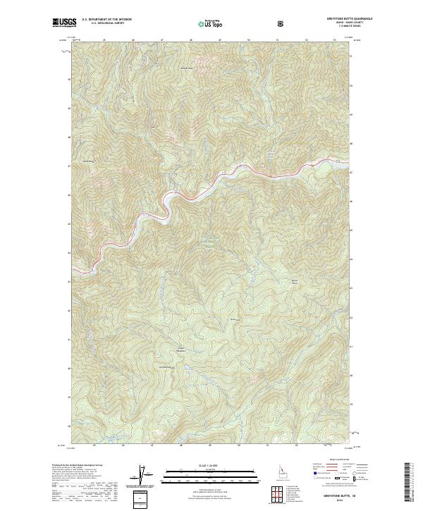
2024 Map of Greystone Butte
USGS Topo · Published 2024About this map
The Middle Fork Clearwater Wild and Scenic River and the Lochsa River dominate this high-elevation Idaho landscape, marking a transition between the Clearwater National Forest and the Selway-Bitterroot Wilderness. The terrain is characterized by prominent landmarks such as Ashpile Peak, Grave Butte, and Greystone Butte, which overlook a network of tributary drainages including Indian Grave Creek and Sponge Creek. A notable point of interest is the Weir Creek Hot Springs, located north of the river near RD 107. The presence of Indian Meadows and Greystone Lake suggests small pockets of level ground and high-mountain water sources amidst the steep topography. Transportation is limited to forest service routes like Nat For Dev RD 5905, reflecting the area's protected status and focus on natural preservation.
Find a feature on this map
37 named features on this map. Tap any name to fly to it.
Don’t see what you’re looking for? This feature index may not catch every label — zoom into the map to look around manually.
Map Details
Editions of this 2024 Greystone Butte Map
This is the sole edition of this map. No revisions or reprints were ever made.
Other maps of this area

1911 · Lolo
USGS Topo · 1:250,000

1913 · Lolo
USGS Topo · 1:250,000

1956 · Hamilton
USGS Topo · 1:250,000

1959 · Hamilton
USGS Topo · 1:250,000

1960 · Hamilton
USGS Topo · 1:250,000

1964 · Hamilton
USGS Topo · 1:250,000

1965 · Lookout Peak
USGS Topo · 1:24,000

1965 · Horseshoe Lake
USGS Topo · 1:24,000

1966 · Mc Connell Mtn
USGS Topo · 1:24,000
1966 · Bear Mountain
USGS Topo · 1:24,000