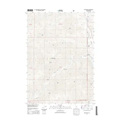
2013 Map of Griffin Butte
USGS Topo · Published 2013About this map
The town of Ketchum serves as the gateway to the high-elevation valleys and gulches that characterize this portion of the Sawtooth National Forest. The map documents a landscape defined by its thermal features and outdoor recreation, with Guyer Hot Springs and Warfield Hot Spring located along the winding path of Warm Springs Cr. To the south, the massive profile of Bald Mtn overlooks the valley, while Griffin Butte stands to the north, separated by a network of drainage basins including Adams Gulch and Eve Gulch. Local transportation is anchored by State Hwy 75 running parallel to the Big Wood River, connecting the residential developments of the valley floor to the backcountry campgrounds and lakes such as Penny Lake and Dollar Lake. This 2013 survey provides a clear view of the modern infrastructure and recreational sites supporting the region's mountain economy.
Find a feature on this map
53 named features on this map. Tap any name to fly to it.
Don’t see what you’re looking for? This feature index may not catch every label — zoom into the map to look around manually.
Map Details
Editions of this 2013 Griffin Butte Map
This is the sole edition of this map. No revisions or reprints were ever made.
Other maps of this area

1895 · Hailey
USGS Topo · 1:125,000

1897 · Hailey
USGS Topo · 1:125,000

1900 · Sawtooth
USGS Topo · 1:125,000

1955 · Hailey
USGS Topo · 1:250,000

1959 · Hailey
USGS Topo · 1:250,000

1962 · Hailey
USGS Topo · 1:250,000

1967 · Rock Roll Canyon
USGS Topo · 1:24,000

1967 · Mahoney Butte
USGS Topo · 1:24,000

1967 · Sun Valley
USGS Topo · 1:24,000

1967 · Hailey
USGS Topo · 1:24,000