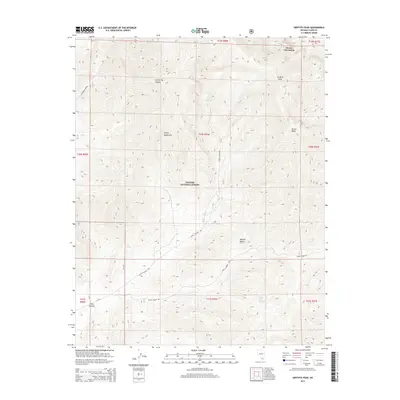
2014 Map of Griffith Peak
USGS Topo · Published 2014About this map
Griffith Peak and Mount Charleston dominate the northern terrain of this high-elevation landscape within the Toiyabe National Forest. The map documents a sharp transition in the Spring Mountains, where the limestone heights give way to the Mojave Desert in the southeast. This environment is defined by its vital water sources, including Lees Spring, Trout Springs, and Mazie Spring, which have historically dictated travel and survival in this arid region. The drainage patterns are clearly visible through Lee Spring Canyon and Trout Canyon, while human passage is marked by Lovell Canyon Rd and Lovell Summit Rd, tracing the lower contours and passes of the range. The cartography illustrates the complex topography of Sexton Ridge and the surrounding wilderness as it appeared in the early 21st century.
Find a feature on this map
24 named features on this map. Tap any name to fly to it.
Don’t see what you’re looking for? This feature index may not catch every label — zoom into the map to look around manually.
Map Details
Editions of this 2014 Griffith Peak Map
This is the sole edition of this map. No revisions or reprints were ever made.
Other maps of this area

1907 · Las Vegas
USGS Topo · 1:250,000

1908 · Las Vegas
USGS Topo · 1:250,000

1954 · Las Vegas
USGS Topo · 1:250,000

1957 · Las Vegas
USGS Topo · 1:250,000

1957 · Mt. Stirling
USGS Topo · 1:62,500

1957 · Charleston Peak
USGS Topo · 1:62,500

1957 · Mountain Springs
USGS Topo · 1:62,500
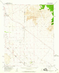
1958 · Pahrump
USGS Topo · 1:62,500

1959 · Las Vegas
USGS Topo · 1:250,000

1962 · Las Vegas
USGS Topo · 1:250,000